
Bridge preemptively closed following a WhatsApp alert, not citizen distress calls
When the Ave rises, Naceiros bridge goes under, 35 minutes from the operations centre. The decision to close it used to wait for residents' warnings. Now it is closed based on real-time flood sensor data.
The challenge
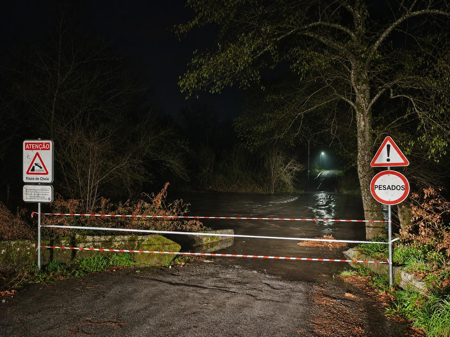
Guimarães has several remote points where flooding occurs. Naceiros bridge is 35 minutes from the Operations Centre, on the border with Póvoa de Lanhoso. When the Ave rises the bridge goes under, and traffic was only stopped after residents called in, when the bridge was already impassable, or when a team had time to check on site.
How can the state of a bridge be monitored, so it is closed before residents report it as an emergency?
What we deployed
A flood sensor on the bridge deck detects the moment just before water starts covering the structure and alerts Civil Protection straight away. The timely alert allows barriers to be deployed, minimising the risk to vehicles and pedestrians.
What changed
The decision to close or reopen the bridge now follows the sensor's flood status, in coordination with the Municipal Civil Protection Service of Póvoa de Lanhoso, so both sides of the border act on the same information.
- Prevention through anticipation
- Operational efficiency
Why it matters
Flooded bridges are among the most dangerous places in a flood: drivers misjudge depth and current, and a few tens of centimetres of moving water can be enough to sweep a car away. Closing the bridge when the water arrives, not when someone reports it, removes that window of risk. Reopening it as soon as the deck is clear keeps a link between two municipalities working, without guesswork or unnecessary risks.
- Drivers attempting a submerged crossing
- Closures that depend on residents' emergency calls
- Uncoordinated decisions on each side of the border
GET A FLOOD-RISK ASSESSMENT FOR YOUR CITY
Tell us about your city — we'll send back a 1-page readiness brief and schedule a technical call.